
Finally got my pictures from WA/CA last week but I haven't had time to put them up yet. Feels weird that some of these were less than a month ago because it seems like I've already been in New York for months.
Near Seattle at the top of Rattlesnake ledge with Erik, Rosie, Zelda, Sam, Rebecca and Random Guy and on the boat with Zelda, Lyra and Orion:


In Petaluma on the farm with Becca, Darcy and Alex:


More pictures on Flickr.
Showing posts with label Photography. Show all posts
Showing posts with label Photography. Show all posts
Saturday, September 22, 2012
West Coast Pictures

Saturday, August 11, 2012
Goat Rocks and more!
I'm gettin ready to leave Seattle on Tuesday, feels like I just got here though. Last week Seattle Eric and our friend Rebecca from Utah went to Goat Rocks wilderness to do some walkin around. It was a three day trip and even with a couple wrong turns we only hiked about 15 miles. That left a lot of time for sittin on our stone furniture at the campsite and throwin snowballs. I took a real great picture of the valley we were hikin around but then I dropped my camera in the river and it went off a waterfall, whoops!
I got some last film pictures from Alaska developed the other day and here are some good ones. I guess I'll have film pictures of Seattle sometime soon but not yet.
Our friends Joe and Elieen in Denali with Erik/Me and Erik at the bus in Denali:


200 feet above a river on the way to McCarthy/The copper mill building in Kennecott:


Sam on the Kennicott Glacier/Rainbow near the glacier:


Wednesday, July 18, 2012
Mt. Prindle Via Faith Creek
Over the weekend we drove up the Steese Highway to try to hike into Mt. Prindle. The mountain is a rock climbing hot spot but is also supposed to be a good hike and Sam wanted to scope out the climbing. The first night we left at around midnight during "civil twilight" and drove for a couple hours to Cripple Creek Campground at mile 60. The next morning we drove a few miles further, forded some creeks in Bowie, Sam's truck and started down the trail. We realized after about 2 miles that we hadn't driven to the spot we were supposed to park at and that we could have saved an hour of hiking on either end.
Our campsite the first night and fording one of the early creeks:


After that we followed Zephyr creek up the mountain crossing it about 10 times along the way. When we reached the top of the ridge the forest we had been following the creek through turned into tundra and the trail seemed to disappear. Instead of following what we thought was a trail that led to a different climbing spot we decided to bushwhack through the tundra which was very slow going. In the tundra natural lines turn into trail mirages all the time in the distance so after following a few trail visions and coming up empty we decided to go straight up to the top of the ridge where we found the rock cairns marking the trail we were supposed to be on.
Sam consulting the map and a picture from the top of the ridge:


Once we reached the ridge line it was a relatively easy walk down to a great campsite. Just down the creek from our tents was a large block of ice along the river where we discovered an ice cave! The next day we tried to take a day hike to try to reach the main climbing wall at Mt. Prindle but we only made it over and down the next ridge before the thick tundra turned us back. We declared victory, hiked back up the steep ridge and on the way back down discovered the remnants of a trail we hadn't seen hiking up.
Sam and Erik on the day hike/on the ice:

Salgu in front of the ice cave:

On Monday we hiked back to the car, making sure to stay along ridgelines instead of going down into the thick tundra in the valleys. It was a rainy day but that helped keep the mosquitoes away. We made it back to the car and didn't have to worry at the river crossings because we were already wet!
Sam, Salgu and Meg on the ridge/At the campsite:


Saturday, July 14, 2012
Granite Tors
Erik and I went to Granite Tors for 3 days. The hike is a 15 mile loop and at the top along the ridge are large rock outcroppings called 'tors'. We hitched a few rides down Cheena Hot Springs road and got there Tuesday afternoon. It started raining right when we started the hike and didn't stop but fortunately we were able to camp at the trail shelter which had a woodstove in it. The next day we day hiked around the tors climbed on them a bit. The trail through the tundra was pretty overgrown and tough to walk through. The next day we hiked down and apparently just missed a close call with a bear?
Hitchin down the road/it was rainy the first day:


Our Cabin/stove:


At the tors!


Friday, July 13, 2012
Pictures from Tangle Lakes/Delta River
Here are the pictures from last week's trip down Tangle Lakes and the Delta River. We just got back from Granite Tors so there will be pictures from there soon too. We're headed down the Steese Highway tonight to either Pinnell Mountain or Mount Prindle, not sure which yet!
Driving down:


At the pipeline:


At the lakes:


At the first campsite:


We portaged around this waterfall:


Fishin:


Down the river:


Thursday, March 1, 2012
Real Life Pics
When I was in Seattle my friend Jen was trying to take 'real life pics' to send to her brother so that he could know what her 'real life' was like. She forgot her camera a couple times so I took some to send to her. I managed to get some real life pics in San Francisco while I was there too!
In SF while I felled a tree some neighbor kid helped Bonnie dig plastic grass out of the compost! Later Mariah and mom had a video chat staring contest:


When I took off from SF the whole city was covered in clouds with Sutro Tower sticking out, it's a little blurry but if you click through to the big size you can probably make it out. Then when I got to Seattle it was cloudy but it got sunny the next day. The view from the light rail in SoDo:


Real life pics - in the car, at the restaurant, group hug:


Saturday, December 24, 2011
Gelatin Silver Photographs
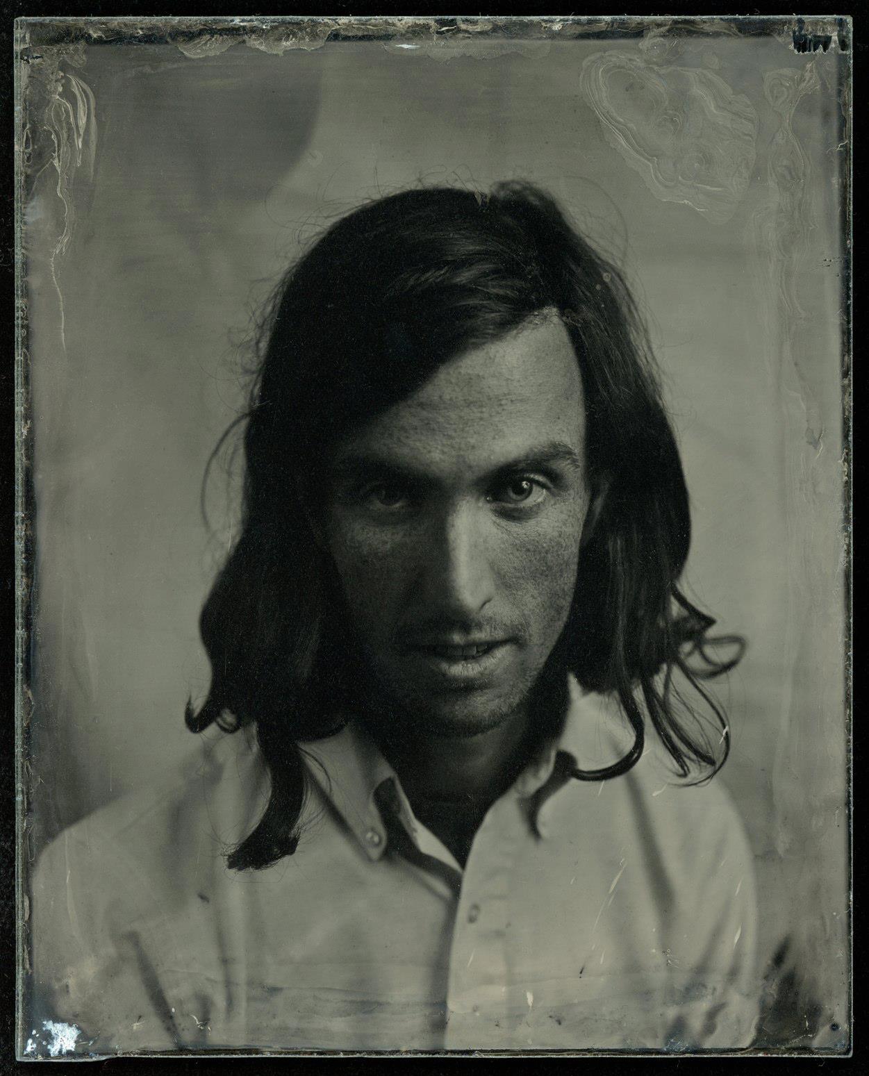

The photographs have to be developed within a few minutes of the plate being exposed and the images slowly appear on the plate, cloudy at first but within a few minutes they clear up a lot.
To prepare the plates he starts with some egg white glue on the edges to keep the image from peeling away later. He then puts on a layer of a combination of cotton and ether to help the silver stick to the plate. Next, the silver is put on inside a dark box because this is the light sensitive chemical. The camera he uses is from the 70's and is about a 1' cube, though it can expand more since it has bellows. Once the plate is exposed he pours the developer on by hand and then stops the development with water. The whole process takes about 15 minutes. The boomerang shaped hole in the second image is a place that didn't get any of the cotton-ether bonding agent so the light sensitive chemicals didn't stick.
The texture of my skin in the images is because the silver shows some of the ultra-violet spectrum that is invisible to the human eye so you can see under the first layer of skin.
Monday, August 22, 2011
Bike Trip Pictures
We just made it back to Hilo after riding from Punalu'u Beach over Volcano. It took us six hours to ride the 30 miles (and 4000 feet) up the volcano but only one and a half rainy hours to ride the 30 miles back down to Hilo. Other than that the weather was nice for the whole trip and we didn't regret not bringing sleeping bags! Here are some pictuers from the trip:


Eve after the first 100 miles and climbing a hill.


My bike coming down to Punalu'u and the first campsite near Waimea.
Subscribe to:
Posts (Atom)